- Overview
- Spotlight
- Photos
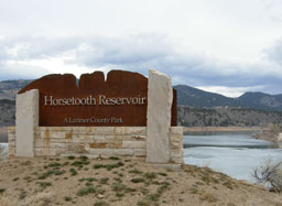
Horsetooth Mountain Open Space was established as a regional park in 1982 as a way to preserve the mountain and its natural and cultural history from residential development. From 1998 to 2003, the Hughey, Culver and Soderberg Homestead Open Spaces were added to the Horsetooth Mountain property. Today, the combined properties total 2, 711 acres of land. A visit to any of the properties provides the opportunity to discover multiple windows back in time, including old sandstone quarries, mysterious low rock walls, and the original road to Estes Park, all in one afternoon.
The landscape of Horsetooth Mountain Open Space has been the backdrop for an immense scope of human history, reaching back more than 12,000 years. For thousands of years, American Indian tribes traveled the land, hunting, gathering, camping, and living in the red rock canyons that wind through the property. Euro-American fur trappers and traders arrived in the early 1800s, and the discovery of gold and silver in the Horsetooth Valley in 1858 lead eager prospectors to try their hand at mining. Soon after, settlers began homesteading on the mountain and by the 1880s the population grew as the industries around the mountain – logging, quarrying, ranching, farming and digging Horsetooth Reservoir– all proved to be profitable.
Horsetooth Reservoir itself is 6.5 miles long, open year round for recreational activities, and is a part of the Colorado-Big Thompson Project. This water project is managed by the Bureau of Reclamation and the Northern Colorado Water Conservancy District and diverts water from the Western slope of Colorado for drinking water, irrigation, and hydropower generation on the Eastern slope.
Under the waters of the Horsetooth Reservoir lie the remains of the town of Stout. Established in the 1880s as a camp for workers at the nearby stone quarries in the area, the Union Pacific Railroad at one time built a rail spur from Fort Collins to Stout in order to transport stone. The town was abandoned in 1949 to make way for the reservoir. Many of the historic buildings in Fort Collins (including the Fort Collins Museum of Discovery) and on the Colorado State University campus are built from the red sandstone quarried from Stout. Another historic remnant of the quarrying industry is Fort Collins’ Canyon Avenue, so named because it was along this street that stone was hauled into town from the canyon quarries in Stout.
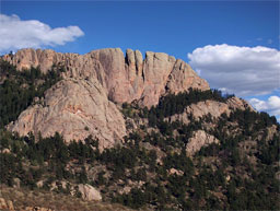
Horsetooth Rock was named, simply, because early Euro-American settlers saw the rock and thought it looked like a horse’s tooth. However, another story attributed to the rock is more complicated.
For many generations, residents of Fort Collins and the surrounding area have grown up hearing about “The Legend of Horsetooth Rock.” The story goes:
Long ago, before Horsetooth Mountain existed, the Valley of Contentment sat at the base of the mountains and the Indians who lived in the valley were happy and peaceful. But there was a giant who wanted the valley for himself, looking down into it from his home in the mountains. Stronger and more powerful than the Indians, the giant forbade anyone to live in the valley, banishing the people from their home.
The Indians called upon their most powerful chief, Chief Manumoku, to lead them against the giant. At first, it seemed hopeless, but then Manumoku learned that, during the full moon, the giant slept with his heart exposed outside of his body, guarded by a huge nighthawk. At the next full moon, Manumoku lured the nighthawk away from the sleeping giant and, reaching up into sky, pulled a glittering tomahawk down from the stars. Raising the tomahawk above his head, Manumoku brought the blade onto the giant’s heart, cleaving it in two. But the giant was not dead. So Manumoku raised the tomahawk two more times, striking deep on the right and left sides of the giant’s heart. With that the giant died; his body and heart turning to granite stained red with the blood that flowed out of him and becoming Horsetooth Mountain.
This story, incredibly popular and full of adventure, bravery, heroics and magic, is often presented as an authentic American Indian legend. There’s just one problem: it’s not.
To the best of historians’ knowledge, the story was invented by Hugo Frey, a white man who lived in Fort Collins in the early part of the 20th century. At that time, it was very common for Euro-Americans to appropriate and romanticize American Indian cultures and create legends and histories that they then attributed to tribes. Hugo Frey’s story appears to draw heavily from the time he spent in the South Pacific, with names like ‘Manumoku” linguistically more Polynesian than western American Indian. In addition, no American Indian tribe with a historical presence in northern Colorado has ever claimed the story as their own.
The “Legend of Horsetooth Rock” may not be authentic, but that’s all right. The real stories of Horsetooth Mountain are more than interesting enough.
Click any of the red pins on the map to see visitor information about that site.
Download a printable version of Tour 1 complete with directions, maps, and activities.
Open this tour in Google Earth by downloading the KML version of this map.
Download a PDF of the brochure for Horsetooth Mountain Open Space.
Red Mountain Open Space
- Managing Agency
- Larimer County Department of Natural Resources
- Open
- March 1 to November 30
- Fees
- None. Consider purchasing a Park Permit to help support Larimer County Department of Natural Resources
Red Mountain Open Space is rugged and remote - always carefully prepare for your experience. Carry plenty of water and extra food. Watch the weather closely - fast-moving thunderstorms and high winds are common.
Read the brochure for all the rules and regulations.
Hiking the Anticline Trail
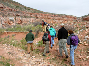
photo by Terry Burton
Gateway Natural Area
- Managing Agency
- City of Fort Collins Natural Areas Program
- Hours
- Sunrise to sunset
- Fees
- Required March 1-November 30
- $5.00 per standard vehicle
- $10.00 per commercial vehicle, bus, motor home,trailer, or van occupied with 8 or more passengers. Annual pass available.
Hiking, fishing, picnicking, and relaxing by the river makes Gateway a place for all. Each season is special - visit all year round. For your protection, no overnight parking or alcohol is allowed at Gateway. All pets must be leashed. Use grills provided or table-top gas grills only.
For information on renting a picnic shelter rental, call 970-416-2815.
Fall reflections along the Poudre
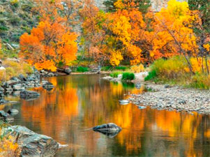
photo by Richard Ernst
Reservoir Ridge Natural Area
- Managing Agency
- City of Fort Collins Natural Areas Program
- Hours
- 5:00 am to 11:00 pm
- Trails
- About 3.5 miles of soft surface trail. Connects to the Foothills Trail.
Visitors to this foothills natural area enjoy its rugged trails, access to the 6.8 mile Foothills Trail, wildlife viewing opportunities and a feeling of remoteness-- all close to Fort Collins. You’ll see dramatic rock outcroppings, grasslands, mountain mahogany shrubs and a few ponderosa pines. Views of the city and Horsetooth Reservoir are great from the trails!
Flowers on the hillside
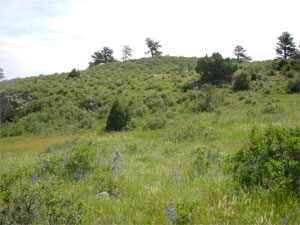
photo by City of Fort Collins Natural Areas Program
Horsetooth Mountain Open Space
- Managing Agency
- Larimer County Department of Natural Resources
- Open
- Open year-round from sunrise to sunset
- Fees
- Park permit required for all visitors, including walk-in and bike-in
Horsetooth Mountain Open Space (consisting of Culver, Soderberg, and Hughey Open Spaces) is a scenic 2,711 acre park located on the west side of Horsetooth Reservoir. This is a very popular open space, so if you should arrive and find the parking lot full you will know that the trails are at maximum capacity. Please consider one of our other open spaces for your outdoor enjoyment that day, and come back to Horsetooth Mountain Open Space another time.
Read the brochure for all the rules and regulations.
Mountain biking in Horsetooth Mountain Open Space
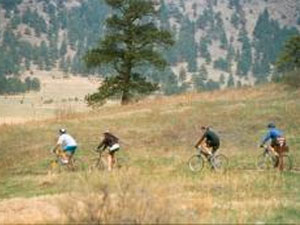
photo by Mike Strunk
Bobcat Ridge Natural Area
- Managing Agency
- City of Fort Collins Natural Areas Program
- Hours
- Open daily from dawn until dusk
- Trails
- Valley Loop (4 mile loop), Ginny Trail (5.4 miles, climbs 1,500 feet, open for hiking and mountain biking, closed to horses), D.R. Trail (3.4 miles long, climbs 1,100 feet, open to equestrians and hikers, closed to cyclists), Powerline Road (1.5 miles long, climbs steeply with loose rocks so not recommended for horses, uphill only for cyclists), Eden Valley Spur (an out and back route, 1.3 miles along the valley bottom)
Discover Bobcat Ridge Natural Area! You’ll find a grassy valley, foothills, ponderosa pines, stunning red rock cliffs and more. Bobcat Ridge is home to elk, wild turkey, mountain lions and other wildlife. Several historic homestead sites dot the landscape.
Hiking the Valley Loop trail
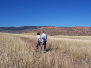
photo by City of Fort Collins Natural Areas Program
Devil's Backbone Open Space
- Managing Agency
- Larimer County Department of Natural Resources
- Open
- Open year-round from sunrise to sunset
- Fees
- None. Consider purchasing a Park Permit to help support Larimer County Department of Natural Resources
The 2198-acre Devil's Backbone Open Space provides abundant opportunities on a seven-mile trail for outdoor recreation including hiking, running, horseback riding, mountain biking, wildlife viewing, observing nature, as well as enjoying close-up inspection of the rock outcrop and long vistas of the area, while on the trail.
This is a very popular open space, so if you should arrive and find the parking lot full you will know that the trails are at maximum capacity. Please consider one of our other open spaces for your outdoor enjoyment that day, and come back to the Devil's Backbone another time.
Read the brochure for all the rules and regulations.
Devil's Backbone rock formation
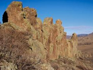
photo by Larimer County Department of Natural Resources


