- Overview
- Spotlight
- Photos
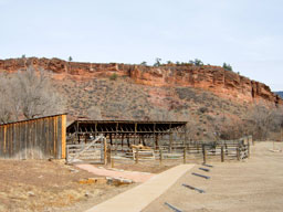
The Ute hunters made their way down towards the area with the red rocky ridges, a place rich in game. They had been traveling this route for many generations and although they knew the route intimately, they had to be cautious. There were many strangers moving about the area, and each time the Utes came east from the mountains, there seemed to be many more. These strangers were building permanent houses in their hunting areas and moving new kinds of animals about the land. The Utes' enemies, the Arapahos, were also more frequently in the area and the Utes had gotten into skirmishes with them not too long ago in the area of the red rocks where they were heading. The Ute people were staying more and more in the mountains, especially since there weren’t as many bison to be found as in the old days.
Evidence dating back millennia show that American Indians had been traveling and living in the area where Bobcat Ridge Natural Area exists today. Consisting of varied topography—mountains, cliffs, rolling terrain, drainages and flat valley areas—it was part of many peoples’ traditional migratory routes, used for hunting, making pilgrimages up to the high mountains in what is now Rocky Mountain National Park, and meeting with other groups of Indians.
Bobcat Ridge itself consists of forested hills covered by ponderosa pine and Douglas fir up to 7,000 feet in elevation in its western section, while the valley consists of open, flat grasslands and agricultural areas. Hogback ridges made up of red sandstone cliffs, part of what the Arapaho Indians called the Red Rock Road, create two unique canyons that cut through the hogback and drain eastward. Buffum Canyon is located on the north end and provides the main access to the site, while Brooks Canyon is located to the south. Once American Indians were forced to leave the area in the mid-to late-1800s, Euro-Americans continued moving in, recognizing the promise of the land for cattle ranching and farming. Bobcat Ridge is a place now open to new types of journeys—recreational in nature, rather than based on subsistence.
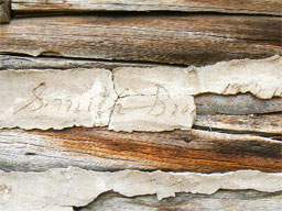
Sarah Milner Smith sewed the last button on the shirt. Folding it neatly and placing it on top of the stack of mending that she’d completed for the Barnes family, Edward, her oldest child, could deliver it tomorrow morning. Sitting back in her rocker, she mentally calculated how much money this would add to her weekly earnings. Since her husband had died of pneumonia three years ago and left her a widow at age 34, she had done whatever work she could to take care of herself and their three children—including selling eggs and butter, taking in boarders, serving meals, and the sewing.
As the first to awaken and the last to bed, Sarah sat enjoying the quiet and thinking back on her short but full life with her late husband Edward Smith Sr. A man much like her father—a hard worker who could always see an opportunity in spite of adversity—they had met when they were both teaching, he at the privately financed school on the Big Thompson River and she as the first teacher of a public school in Larimer County. While a student at the University of Michigan, he had contracted tuberculosis and doctors thought the arid western air would be good for him—so he had traveled west to homestead along the Big Thompson in the 1860s.
It did do him well, she thought, although whenever he tried to work at jobs that kept him indoors, his health always seemed to give way. It was his health and longing to do work outside that had shaped the journey they had found themselves on since their marriage in 1870, just a little over ten years ago. From the cozy little home Edward had built on the Big Thompson after selling his original homestead, to their subsequent homesteads in southern Colorado in the Arkansas and Purgatory River valleys, she found herself back where she started, in the foothills of the Rocky Mountains.
Sarah Milner Smith’s journey had taken her and her family from the foothills to the plains and back to the foothills of Colorado. After the death of her husband, she and her sons took out claims on Buckhorn Creek near Buffam Canyon, now part of the Bobcat Ridge Natural Area. It was Sarah’s daughter Alice, who, with her husband John Spence, started a family that figured significantly in the story of Bobcat Ridge. It was from these early adventurers that the Smith Brothers cattle ranching business was born. Sarah, like so many women who settled in the area in the past or continue to work the land either as ranchers or farmers today, faced her life’s journey with a “can-do” attitude.
Click any of the red pins on the map to see visitor information about that site.
Download a printable version of Tour 1 complete with directions, maps, and activities.
Open this tour in Google Earth by downloading the KML version of this map.
Download a PDF of the brochure for Bobcat Ridge Natural Area.
Red Mountain Open Space
- Managing Agency
- Larimer County Department of Natural Resources
- Open
- March 1 to November 30
- Fees
- None. Consider purchasing a Park Permit to help support Larimer County Department of Natural Resources
Red Mountain Open Space is rugged and remote - always carefully prepare for your experience. Carry plenty of water and extra food. Watch the weather closely - fast-moving thunderstorms and high winds are common.
Read the brochure for all the rules and regulations.
Hiking the Anticline Trail
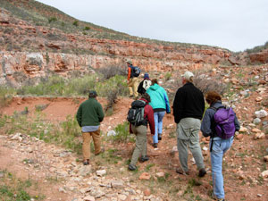
photo by Terry Burton
Gateway Natural Area
- Managing Agency
- City of Fort Collins Natural Areas Program
- Hours
- Sunrise to sunset
- Fees
- Required March 1-November 30
- $5.00 per standard vehicle
- $10.00 per commercial vehicle, bus, motor home,trailer, or van occupied with 8 or more passengers. Annual pass available.
Hiking, fishing, picnicking, and relaxing by the river makes Gateway a place for all. Each season is special - visit all year round. For your protection, no overnight parking or alcohol is allowed at Gateway. All pets must be leashed. Use grills provided or table-top gas grills only.
For information on renting a picnic shelter rental, call 970-416-2815.
Fall reflections along the Poudre
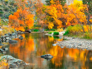
photo by Richard Ernst
Reservoir Ridge Natural Area
- Managing Agency
- City of Fort Collins Natural Areas Program
- Hours
- 5:00 am to 11:00 pm
- Trails
- About 3.5 miles of soft surface trail. Connects to the Foothills Trail.
Visitors to this foothills natural area enjoy its rugged trails, access to the 6.8 mile Foothills Trail, wildlife viewing opportunities and a feeling of remoteness-- all close to Fort Collins. You’ll see dramatic rock outcroppings, grasslands, mountain mahogany shrubs and a few ponderosa pines. Views of the city and Horsetooth Reservoir are great from the trails!
Flowers on the hillside
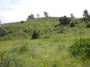
photo by City of Fort Collins Natural Areas Program
Horsetooth Mountain Open Space
- Managing Agency
- Larimer County Department of Natural Resources
- Open
- Open year-round from sunrise to sunset
- Fees
- Park permit required for all visitors, including walk-in and bike-in
Horsetooth Mountain Open Space (consisting of Culver, Soderberg, and Hughey Open Spaces) is a scenic 2,711 acre park located on the west side of Horsetooth Reservoir. This is a very popular open space, so if you should arrive and find the parking lot full you will know that the trails are at maximum capacity. Please consider one of our other open spaces for your outdoor enjoyment that day, and come back to Horsetooth Mountain Open Space another time.
Read the brochure for all the rules and regulations.
Mountain biking in Horsetooth Mountain Open Space
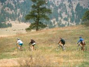
photo by Mike Strunk
Bobcat Ridge Natural Area
- Managing Agency
- City of Fort Collins Natural Areas Program
- Hours
- Open daily from dawn until dusk
- Trails
- Valley Loop (4 mile loop), Ginny Trail (5.4 miles, climbs 1,500 feet, open for hiking and mountain biking, closed to horses), D.R. Trail (3.4 miles long, climbs 1,100 feet, open to equestrians and hikers, closed to cyclists), Powerline Road (1.5 miles long, climbs steeply with loose rocks so not recommended for horses, uphill only for cyclists), Eden Valley Spur (an out and back route, 1.3 miles along the valley bottom)
Discover Bobcat Ridge Natural Area! You’ll find a grassy valley, foothills, ponderosa pines, stunning red rock cliffs and more. Bobcat Ridge is home to elk, wild turkey, mountain lions and other wildlife. Several historic homestead sites dot the landscape.
Hiking the Valley Loop trail
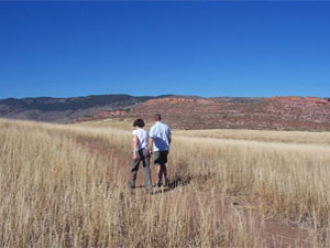
photo by City of Fort Collins Natural Areas Program
Devil's Backbone Open Space
- Managing Agency
- Larimer County Department of Natural Resources
- Open
- Open year-round from sunrise to sunset
- Fees
- None. Consider purchasing a Park Permit to help support Larimer County Department of Natural Resources
The 2198-acre Devil's Backbone Open Space provides abundant opportunities on a seven-mile trail for outdoor recreation including hiking, running, horseback riding, mountain biking, wildlife viewing, observing nature, as well as enjoying close-up inspection of the rock outcrop and long vistas of the area, while on the trail.
This is a very popular open space, so if you should arrive and find the parking lot full you will know that the trails are at maximum capacity. Please consider one of our other open spaces for your outdoor enjoyment that day, and come back to the Devil's Backbone another time.
Read the brochure for all the rules and regulations.
Devil's Backbone rock formation
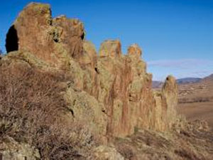
photo by Larimer County Department of Natural Resources


