- Overview
- Spotlight
- Photos
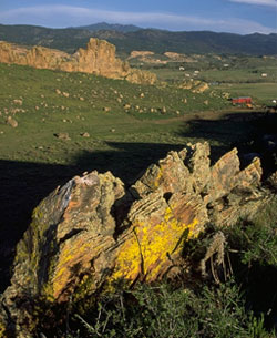
The geology of Colorado has gone through massive and multiple changes that are visible throughout the Front Range. “Hogbacks,” known scientifically as homoclinal ridges, are a fantastic example of those changes. Hogbacks are ridges of rock made up of steeply tilted layers, or strata, of rock jutting out from the surrounding landscape. The rock formations are usually made up of two different types of sedimentary rock (rock created when layers of sediment are deposited atop one another) that erode at different rates, creating cliffs that become steeper and steeper as the softer sedimentary rock continues to erode. Because of the way the rock erodes, hogbacks are often rich in evidence of the deep geology of a region.
Devil’s Backbone is one such hogback. It’s a spine of hard Dakota sandstone rising about 220 feet above the surrounding valleys that was deposited during the Cretaceous Period, 145 to 65 million years ago, the same time that Tyrannosaurus rex lived. The rock layers are part of the ancient beach that surrounded the Cretaceous Western Interior Seaway, created by erosion from the second rising of the Rocky Mountains mixing with the ancient sea. Today, you can hike trails that take you along this unique natural phenomenon as part of one of Larimer County’s open spaces.
If you look carefully as you hike along the Wild Loop, you can see rock that dates back to the Triassic Period – gypsum. This white, porous rock is composed of the remains of aquatic creatures that lived in Colorado’s inland sea more than 206 million years ago. Besides being an amazing piece of northern Colorado’s ancient past, gypsum also played a role in the region’s more recent history. From the beginning of the 20th century to the 1960s, gypsum was the key ingredient in both making plaster and building the local community that mined the gypsum beds. While digging the gypsum, local miners also found fossils embedded within the rock, including a prehistoric elephant with 5-foot long tusks.
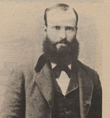
Although the view was expansive from where he stood atop the rocky outcropping people called Devil’s Backbone, Alfred Wild was more interested in what lay at his feet. He owned land at the south end of the rock formation and had recently put in an irrigation ditch. When workers were excavating the ditch, they reached a layer of soft, white material. Wild noticed that when water ran into the ditch it was largely absorbed by this white substance. Sending a sample off to Brown University back east, Wild learned that the material was high quality gypsum, the mineral most often used in manufacturing plaster of Paris and fertilizers.
Researching how to mine and process the mineral, Wild began experimenting with the gypsum on his property by using an old threshing machine as a crude outdoor mill where he heated the gypsum in an iron kettle over an open coal fire to create plaster. Wild then built the Buckhorn Mill, which operated from 1887 to 1965 and partnered with the U.S. Gypsum Corporation in 1915 to mine the mineral and transport it to a plaster mill.
A true entrepreneur, Wild also found success growing fruit and berries, ending up with over 2,000 fruit trees on his land. He also experimented with growing hops and became known as “Colorado’s Pioneer Hops Grower,” selling his crop to the country’s western breweries. Increasing his range of expertise even more, Wild started the Peep O’Day Kiln Company to make bricks from the clay deposits located just above the gypsum he was already mining. Encompassing all of these business endeavors and his home, he incorporated the town of Wild on his property and a rail spur, the Arkins Line, was built from Loveland to provide daily train service. Streets were laid out and the new town appeared on a map. Unfortunately, few people chose to live in the town of Wild, but Wild himself continued selling fruit and hops, his kilns produced bricks until the end of World War II, and the mill continued operating in partnership with the U.S. Gypsum Corporation until 1965 when a flood on Buckhorn Creek destroyed it.
Click any of the red pins on the map to see visitor information about that site.
Download a printable version of Tour 1 complete with directions, maps, and activities.
Open this tour in Google Earth by downloading the KML version of this map.
Download a PDF of the brochure for Devil's Backbone Open Space.
Red Mountain Open Space
- Managing Agency
- Larimer County Department of Natural Resources
- Open
- March 1 to November 30
- Fees
- None. Consider purchasing a Park Permit to help support Larimer County Department of Natural Resources
Red Mountain Open Space is rugged and remote - always carefully prepare for your experience. Carry plenty of water and extra food. Watch the weather closely - fast-moving thunderstorms and high winds are common.
Read the brochure for all the rules and regulations.
Hiking the Anticline Trail
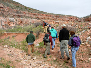
photo by Terry Burton
Gateway Natural Area
- Managing Agency
- City of Fort Collins Natural Areas Program
- Hours
- Sunrise to sunset
- Fees
- Required March 1-November 30
- $5.00 per standard vehicle
- $10.00 per commercial vehicle, bus, motor home,trailer, or van occupied with 8 or more passengers. Annual pass available.
Hiking, fishing, picnicking, and relaxing by the river makes Gateway a place for all. Each season is special - visit all year round. For your protection, no overnight parking or alcohol is allowed at Gateway. All pets must be leashed. Use grills provided or table-top gas grills only.
For information on renting a picnic shelter rental, call 970-416-2815.
Fall reflections along the Poudre
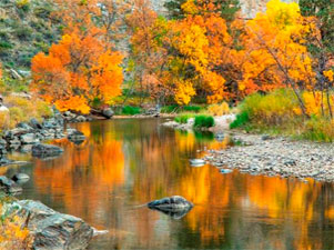
photo by Richard Ernst
Reservoir Ridge Natural Area
- Managing Agency
- City of Fort Collins Natural Areas Program
- Hours
- 5:00 am to 11:00 pm
- Trails
- About 3.5 miles of soft surface trail. Connects to the Foothills Trail.
Visitors to this foothills natural area enjoy its rugged trails, access to the 6.8 mile Foothills Trail, wildlife viewing opportunities and a feeling of remoteness-- all close to Fort Collins. You’ll see dramatic rock outcroppings, grasslands, mountain mahogany shrubs and a few ponderosa pines. Views of the city and Horsetooth Reservoir are great from the trails!
Flowers on the hillside
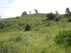
photo by City of Fort Collins Natural Areas Program
Horsetooth Mountain Open Space
- Managing Agency
- Larimer County Department of Natural Resources
- Open
- Open year-round from sunrise to sunset
- Fees
- Park permit required for all visitors, including walk-in and bike-in
Horsetooth Mountain Open Space (consisting of Culver, Soderberg, and Hughey Open Spaces) is a scenic 2,711 acre park located on the west side of Horsetooth Reservoir. This is a very popular open space, so if you should arrive and find the parking lot full you will know that the trails are at maximum capacity. Please consider one of our other open spaces for your outdoor enjoyment that day, and come back to Horsetooth Mountain Open Space another time.
Read the brochure for all the rules and regulations.
Mountain biking in Horsetooth Mountain Open Space
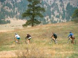
photo by Mike Strunk
Bobcat Ridge Natural Area
- Managing Agency
- City of Fort Collins Natural Areas Program
- Hours
- Open daily from dawn until dusk
- Trails
- Valley Loop (4 mile loop), Ginny Trail (5.4 miles, climbs 1,500 feet, open for hiking and mountain biking, closed to horses), D.R. Trail (3.4 miles long, climbs 1,100 feet, open to equestrians and hikers, closed to cyclists), Powerline Road (1.5 miles long, climbs steeply with loose rocks so not recommended for horses, uphill only for cyclists), Eden Valley Spur (an out and back route, 1.3 miles along the valley bottom)
Discover Bobcat Ridge Natural Area! You’ll find a grassy valley, foothills, ponderosa pines, stunning red rock cliffs and more. Bobcat Ridge is home to elk, wild turkey, mountain lions and other wildlife. Several historic homestead sites dot the landscape.
Hiking the Valley Loop trail
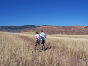
photo by City of Fort Collins Natural Areas Program
Devil's Backbone Open Space
- Managing Agency
- Larimer County Department of Natural Resources
- Open
- Open year-round from sunrise to sunset
- Fees
- None. Consider purchasing a Park Permit to help support Larimer County Department of Natural Resources
The 2198-acre Devil's Backbone Open Space provides abundant opportunities on a seven-mile trail for outdoor recreation including hiking, running, horseback riding, mountain biking, wildlife viewing, observing nature, as well as enjoying close-up inspection of the rock outcrop and long vistas of the area, while on the trail.
This is a very popular open space, so if you should arrive and find the parking lot full you will know that the trails are at maximum capacity. Please consider one of our other open spaces for your outdoor enjoyment that day, and come back to the Devil's Backbone another time.
Read the brochure for all the rules and regulations.
Devil's Backbone rock formation
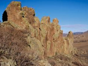
photo by Larimer County Department of Natural Resources


