- Overview
- Spotlight
- Video
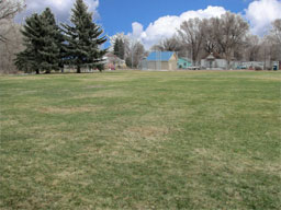
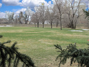
Buckingham Park sits with the banks of the Cache la Poudre River on its western boundary, the innovative and award-winning New Belgium Brewery on its northern boundary, while taking its name from the historic neighborhood to its east and south. The Buckingham neighborhood was built at the turn of the 20th century as a place for the workers of the Great Western Sugar factory. Inhabited for its first 25 years by Germans from Russia, the mid-1920s saw an influx of Hispanic and Mexican workers adding to the changing work force. Buckingham became one of three neighborhoods—Andersonville and Alta Vista the other two—that were built by Great Western Sugar and are more commonly referred to as the Tres Colonias.
The Buckingham Park area was also a popular spot for earlier inhabitants. Chief Friday of the Arapaho and his band lived here before their relocation to the Wind River Reservation in Wyoming in the 1860s. Prior to that, many different American Indian groups, dating all the way back to the late Ice Age, are known to have lived in the area.
Today the park provides a place for the local community to play ball, enjoy the natural legacy of the river, and relax with friends and family—a modern continuation of the long history of all the people who have called this place home.
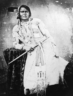
Chief Friday, the leader of a small band of Northern Arapaho who settled along the Poudre River in the 1850s-60s, is the American Indian most associated with the history of Fort Collins and the Cache la Poudre River valley.
Known as Warshinum, or Black Spot, as a child, Friday was separated from his family when he was seven after he became lost on a hunting trip. While his family was unable to find him, he was eventually found by Thomas Fitzpatrick, the head of the Rocky Mountain Fur Company. Fitzpatrick adopted Friday, naming him after the day of the week he was found, and took him to live in St. Louis.
Friday went to school in St. Louis and became proficient in English. On a trip to Colorado in 1843 when Friday was 17, he and Fitzpatrick met a band of Arapaho that included Friday’s family. His family recognized him as the boy they had lost years before and, although it was a hard decision to make, Friday eventually chose to stay in Colorado with his Arapaho family.
As more settlers moved west, Friday’s knowledge of English and Euro-American culture made him invaluable in the ongoing interactions between the Arapaho and the U.S. government. By 1858, Friday had become a minor chief of a band of around 40 people, although at times the number grew to 250.
During the 1860s, Chief Friday was involved in the growing tensions between Euro-American settlers and American Indians. The 1861 Treaty of Fort Wise had reduced the land granted to the Arapaho and Cheyenne to the area between the Arkansas River and Sand Creek. By that time the Arapaho had split into the Northern and Southern tribes, and while the Southern Arapaho signed the treaty, the Northern Arapaho, including Chief Friday’s band, did not.
Remaining in northern Colorado, Chief Friday advocated for the creation of a Northern Arapaho reservation from the mouth of the Cache la Poudre River in the Rocky Mountains down to Box Elder Creek. However, that region of Colorado was highly desired for farming, mining, and ranching and was quickly being settled by newcomers to the area.
Tensions between American Indians and Euro-American settlers culminated in the Sand Creek Massacre on November 29, 1864. Chief Friday and his band, considered “friendly Indians” by the territorial government, were moved to Camp Collins for protection.
Chief Friday and his followers remained in the Cache la Poudre River Valley from 1865 to 1869, when he and his band gave up hope for their own reservation and moved onto the Wind River Reservation in Wyoming. Chief Friday died on the reservation in 1881.
In November 2008, the Fort Collins Museum of Discovery interviewed Mr. Hugh Friday, a great-grandson of Chief Friday, on the Wind River Reservation in Wyoming. In this video, Mr. Friday shares the story of Chief Friday as it has been passed down in his family (5:51 long).
Click any of the blue pins on the map to see visitor information about that site.
Download a printable version of Tour 2 complete with directions, maps, and activities.
Open this tour in Google Earth by downloading the KML version of this map.
Download a PDF of the City of Fort Collins Parks regulations.
Laporte
- Facilities in Laporte
- Restaurant and gas station at Vern's Place, 4120 W County Road 54G
- Groceries available at Overland Foods, 3333 W County Road 54G
- Other nearby historical sites
- Cache la Poudre historical marker, County Road 50E (GPS coordinates 40°37’6"N 105°10’07"W)
- Bingham Hill Cemetery, County Road 50E (GPS coordinates 40°37’6"N 105°08’34"W)
- Historical cabin and DAR marker, County Road 21 (GPS coordinates 40°37’27"N 105°10’07"W)
Laporte, Colorado
Fort Collins Museum of Discovery
- Location
- 200 Mathews Street, Fort Collins
- Hours
- The Museum is closed at its 200 Mathews Street location. The new Fort Collins Museum of Discovery will open on November 11, 2012.
For more information, visit our website at fcmod.org
Other questions? Call us at 970-221-6738Old Carnegie Library Building
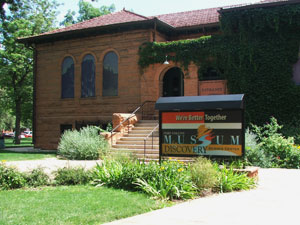
The Fort Collins Museum of Discovery is housed in the 1904 Carnegie Library Building
Old Town Fort Collins
- Parking
- Parking garages are located at the corner of Mason and Laporte, and on Mountain and Remington. For a parking map, click here
- Restaurants
- For a list of Old Town restaurants, click here
- Breweries
- For a list of Old Town breweries, click here
For more information, visit the Downtown Fort Collins website at www.downtownfortcollins.com
Historic Avery Building in Old Town Square
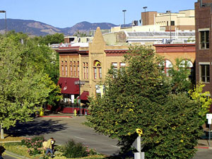
Photo from the City of Fort Collins website
Old Town Heritage Park
- Managing Agency
- City of Fort Collins Parks
- Location
- Old Fort Collins Heritage Park is located at the Northside Aztlan Center, 122 E. Willow Street
- Rules & Regulations
- Read the City of Fort Collins Parks Rules and Regulations here
- Activities & Facilities
- Old Town Heritage Park offers basketball courts, drinking fountains, playgrounds, racquetball courts, a skate park, and a turf area.
The Poudre River at Old Town Heritage Park
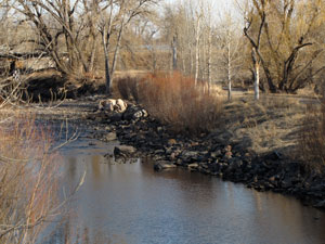
Gustav Swanson Natural Area
- Managing Agency
- City of Fort Collins Natural Areas Program
- Hours
- 5:00 am to 11:00 pm
- Directions
- Parking lot is on Linden Street, between Riverside and Buckingham.
When you visit, look for birds-over 45 species of birds have been seen here including green-winged teal, great blue herons, owls, kestrels, and Bullock’s orioles. Bats, foxes, and deer are also seen here from time to time. Visiting natural areas with a friend or in a group provides the best protection for personal safety.
Free educational programs at Gustav Swanson Natural Area are available for groups by request. Call the Master Naturalist Program at 970-416-2480.
Gustav Swanson Natural Area
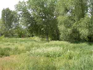
Photo courtesy of the City of Fort Collins Natural Areas Program
Buckingham Park
- Managing Agency
- City of Fort Collins Parks
- Location
- Buckingham Park is located at 101 First Street
- Rules & Regulations
- Read the City of Fort Collins Parks Rules and Regulations here
- Activities & Facilities
- Buckingham Park offers barbeque grills, baseball fields, basketball courts, drinking fountains, playgrounds, restrooms, picnic shelters, and a turf area.
Buckingham Park
